Drone Footage Of Fire Areas Has Been Released, And It’s Spooky [VIDEO]
Some drone footage has been coming out of the fire-ravaged areas of Paradise, and it shows the destructive power, and just how quickly things burned.
By DAVID on November 14, 2018
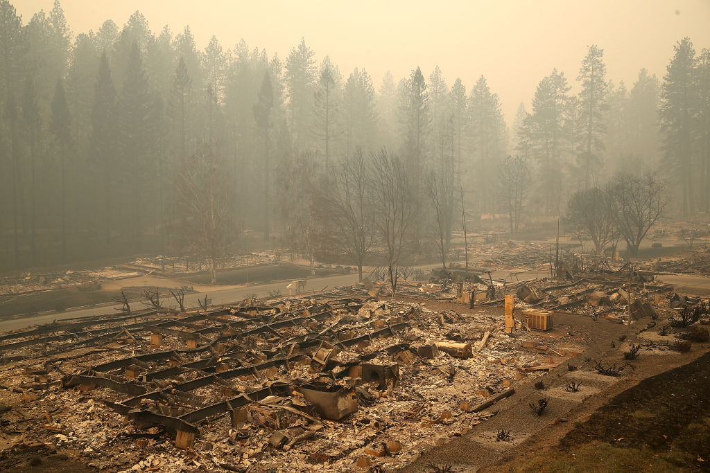
Some local news outlets were allowed to film areas burned by the Camp Fire, primarily the Paradise area. The footage from these videos shows so many homes and businesses completely decimated.
Still, and it’s always odd and happens with every fire – while some neighborhoods are completely burned, there are random houses that are totally fine. Somehow the fire will burn down all the houses surrounding a single house that’s completely untouched. There are other things that might have spared the house, like if the family left water running on the property. Also, it could be just that the grass around the house didn’t catch, and there was no dry brush near the home.
The footage really shows the scale of the fire. Yes, we know it was bad, and we’ve all been affected by the smoke, but when you see the homes, cars, and businesses.. It just really gets the amount of destruction, the number of *things* that people owned, gone. Memories, trophies, childrens’ clothing, art projects, totally gone. A feeling that’s just difficult, if at all possible, to put into words.
If you or a loved one lives in the area, there is a map that was released of a lot of the damaged structures, with pictures. You can see that over here. There are only a couple hundred buildings so far, but they’re working on updating the map as fast as they’re able.